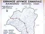

Crete - the Samaria Gorge Tuesday 2001-10-02
The alarm clock I've borrowed from our red-haired landlady (is she Greek or Czech? There are signs in Czech, and there's an empty Czech whiskey bottle in the hallway to the unbuilt 3d floor.) wakes me at 5:48. Gloria later tells me the alarm woke her, but when I dress and leave at 6 she's snoring, so I don't kiss her goodbye as I leave on my great adventure.
Around the corner to the bus stop to buy a ticket for the KETA bus for 1450 drx., a Greek coffee, and to sit till 6:30 or so when we file in to the bus. I get 2 seats in the 3d row, so I can spread out and try to sleep. (I was up from 4 to 5:30.) The bus winds on tiny roads, dropping off tourists at a close-by sleeping village and at Irini gorge, picking up locals and bags (of mail etc.) to drop off at the market town. It arrives at the tourist station at the top of the gorge a little after 8:30. I have an espresso, eat some more of my breakfast roll, buy a ticket for 1200, and start down, taking my time for the scenery and the bumpy, slippery-rocked Xyloskalon. That's Greek for wooden stairs, but the wood only keeps the rocks in place.
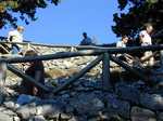
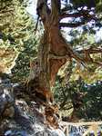
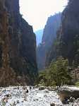
The hike starts with "wooden stairs"
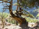
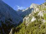
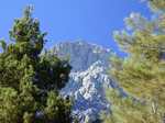
The beginning is well up in the mountains
Presently my upper legs start to ache from the slow descent on rough terrain. Then my knees, especially the right. By the time I descend thru the high-altitude forest to the stream bed, it has turned into a death march. Every climb is easy, especially on gravelly rocks; every descent hurts, especially on slippery black rocks. Others are scurrying, as perhaps I should have done in the beginning - or lost 20 pounds or 40 years.
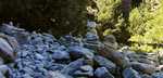
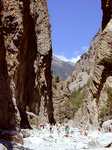
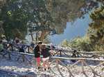
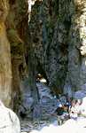
The route gets fairly flat in the bottom third as the river widens.
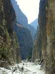
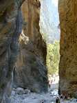
Eventually I get to the high-walled "Gates of Iron", where the gorge narrows down to 3 meters.
I'm glad I took the hike, but I wonder why I didn't take the "easy way" trip and walk up to the Iron Gate. Or would it have been easier to walk all the way up? Only 2 or 4 people did. And then, how do you get down? Or perhaps just take the bus to the top and look around.
Anyhow, I averaged 2 km per hour, a third of my paved-road walking rate of 3 miles per hour. The trip took me from 9 to 3:45, when I arrived in Agia Roumelli at the whistle for the ferry to Hora Sfakion. Fortunately, that wasn't my ferry. Had a large beer, washed up, changed from my hiking boots to my Tevas, and for 2200 bought a ticket for the 4:45 ferry. Napped briefly on the ferry, which was delayed while a helicopter fished somebody or something out of the ocean near Sougia, and got to Paleohora at 6:30, where Gloria waited at the dock. We went immediately for a good stiff drink.
| Previous Crete Page | | Next Crete Page | |
| E-mail Max | Phone Max: (610) 664 2301 |